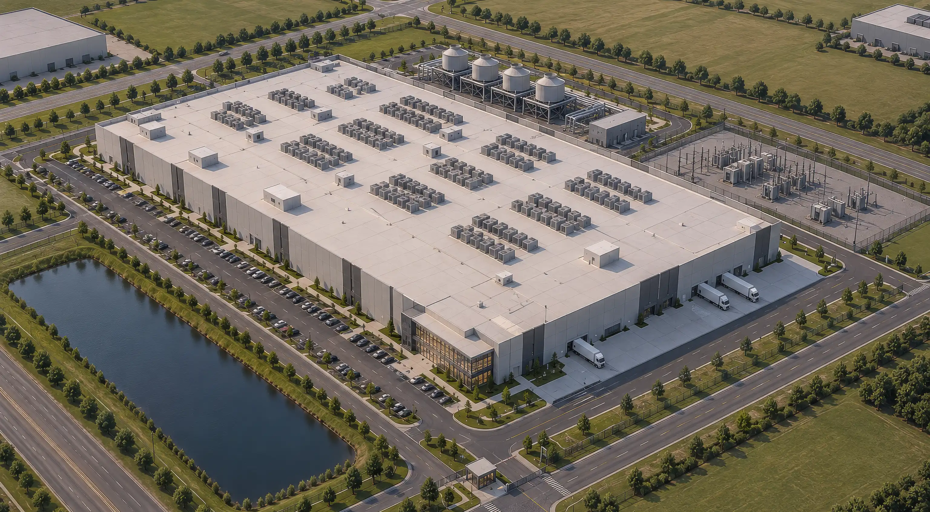
Data center renderings for a community presentation should not start with a generic image list. The right package depends on the local planning, site-plan, or design-review process, but it usually needs to show the site layout, building scale, surrounding properties, landscape screening, facade treatment, and the difference between existing and proposed conditions.
A polished exterior view can still miss the mark if it ignores packet rules, labels, orientation, landscape obligations, or the concerns neighbors are likely to raise. The practical task is to build a reviewable set of visuals that connects to the current site plan, follows local format requirements where they apply, and answers the specific public questions around the project.
Table of Contents
- Start with the review process, not a generic rendering list
- What data center renderings for community presentations usually need to show
- Formatting and drawing conventions matter as much as the images
- How local issues change which views matter most
- Coordinate renderings with the real approval package
- Common mistakes that make a data center presentation less credible
- FAQ
- What to Do Next?
Start with the review process, not a generic rendering list
There is no single required set of data center renderings that fits every community presentation. A project going through planning review, design review, site-plan review, a planned development process, or a local community meeting may need different boards, views, labels, and supporting information. The first step is to confirm which process applies before deciding what to produce.
This matters because the audience is not only judging whether the building looks acceptable. Planning staff, review boards, nearby owners, and residents may be trying to understand where the building sits, how large it feels from public edges, what screening is proposed, how access works, and what conditions are changing. A standard investor deck with attractive exterior perspectives may be useful internally, but it often lacks the site-based information needed for public review.
Start with the jurisdictional guidance, current checklist, and any required packet format. If the review path specifies sheet size, order, drawing conventions, or required exhibits, those requirements should control over presentation preferences. If the process is less formal, the team still needs to decide which questions the visuals must answer and which assumptions are approved for public use.
A helpful early scoping question is simple: is this a marketing deck, or is it a public-review package? A marketing deck may emphasize the best-looking angles, brand impressions, or broad project narrative. A public-review package needs more discipline. It should connect to the current site plan, distinguish existing and proposed conditions, and make scale, edges, and neighboring context clear enough for people who have not been part of the design process.
What data center renderings for community presentations usually need to show
Most useful community presentation renderings answer practical questions about placement, scale, access, and neighborhood fit. The exact scope varies, but a strong baseline usually includes a readable data center site plan, public-facing perspective views, surrounding street or property context, and clear indication of what exists today versus what is proposed.
For data centers, the most important views are not always the most dramatic. A long building wall, a service edge, a parking area, a utility zone, or a landscaped buffer may matter more to a community audience than a carefully composed corner view. If the project team expects questions about building mass, landscape screening, setbacks, or blank facade areas, the rendering set should show those conditions plainly.
Useful views often include:
- An overall site plan or aerial-style site graphic that shows building placement, access points, streets, parking areas, buffers, and adjacent parcels.
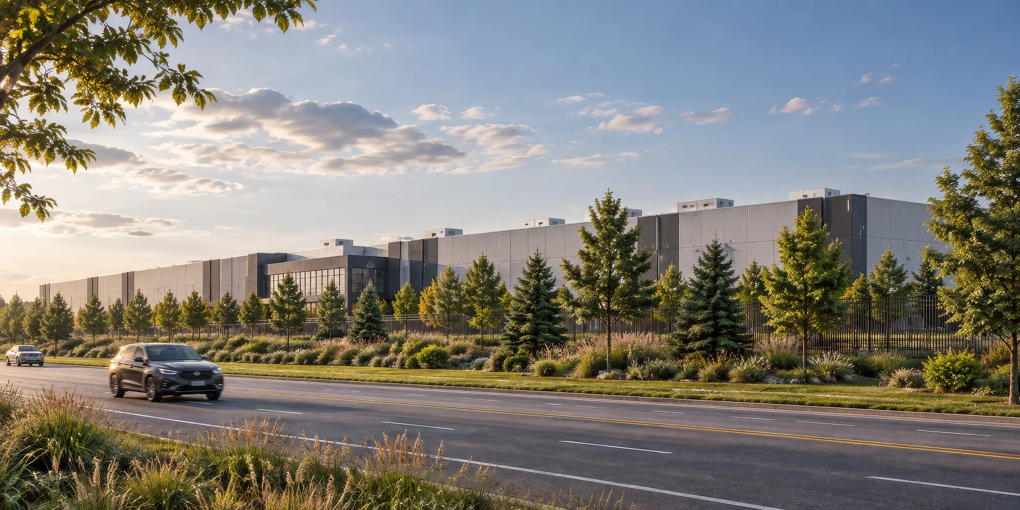
- Eye-level views from public streets, nearby residential edges, or other locations where the building scale is likely to be noticed.
- Existing versus proposed comparisons where the site condition, vegetation, grading, or building presence will change in a visible way.
- Views that show landscape screening, berms, walls, trees, fencing, or planted edges when those elements are part of the proposal.
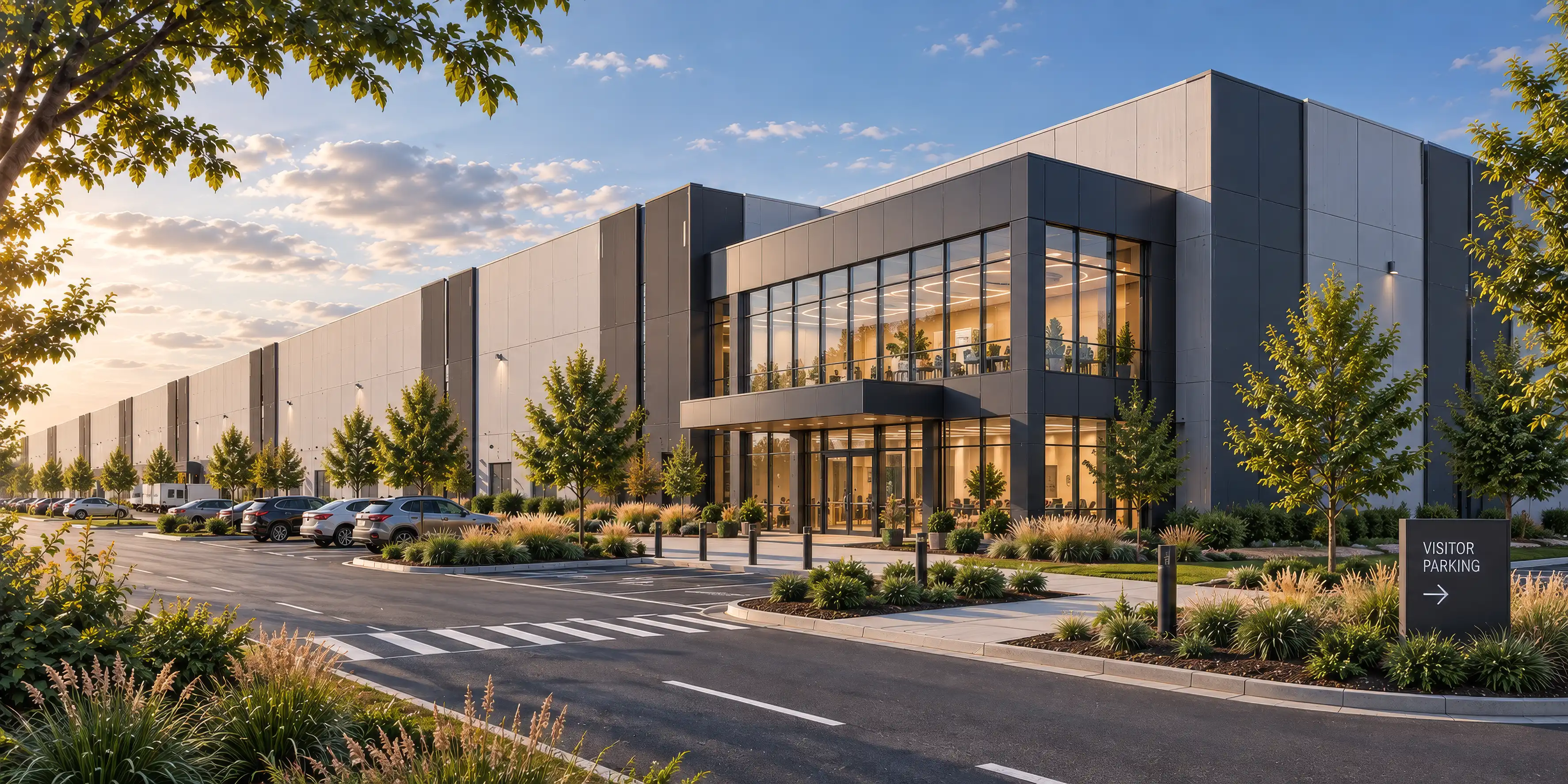
- Facade views that explain articulation, material changes, equipment screening, or long wall treatment where those topics are review-sensitive.
The goal is not to overwhelm the audience with every possible angle. It is to choose the views that answer the real questions. A suburban site near a visible corridor may need careful road-edge views showing planting, setbacks, and massing. A site near industrial uses may need more emphasis on access, service yards, and how the facility relates to neighboring properties. A site with public concern around scale may need simple comparisons and consistent view locations rather than a set of unrelated perspectives.
Formatting and drawing conventions matter as much as the images
In a community or public-review setting, clarity often carries as much weight as visual polish. A rendering that looks refined can still be hard to trust if the viewer cannot tell where the camera is, which way north is, what is existing, or what is proposed. Public boards should be easy to read and easy to cross-reference with the site plan.
Basic conventions help. Use a north arrow on plan-based graphics. Keep orientation consistent across site plans and boards whenever possible. Label major streets, site edges, building entries, service areas, buffers, parking fields, and neighboring uses. If the image shows both existing and proposed features, make the difference legible through labels, notes, linework, tone, or side-by-side comparison.
These conventions are not just graphic preferences. They reduce ambiguity in the room. If one sheet rotates the plan, another uses an unlabeled perspective, and a third blends existing trees with proposed planting, people may spend their time trying to decode the presentation instead of discussing the proposal. That can make a technically accurate image set feel less credible than it should.
Where a jurisdiction has an official packet format, follow it. Some review paths specify checklist structure, sheet size, exhibit order, or content expectations. A beautiful rendering delivered in the wrong format may create avoidable rework or confusion. The safest approach is to treat formatting requirements as part of the rendering brief, not as an administrative detail to resolve after the images are finished.
How local issues change which views matter most
Local review issues should shape the view list. A data center project is usually large, site-intensive, and infrastructure-heavy, but the concerns around it can vary widely by location. One community may focus on landscape buffers and screening from a nearby road. Another may focus on facade massing, parking-edge treatment, view corridors, or how the project changes the character of a site.
Where local guidance addresses large-building design, the rendering set may need to show more than a front elevation. Long walls, repetitive panels, equipment zones, and service-facing facades can become important. In that setting, facade articulation, material rhythm, shadow, and pedestrian-scale frontage treatment may need to be visible enough for review, even if the building is not intended as a highly public-facing structure.
Where landscape or parking-edge guidance applies, planting should not be treated as decorative filler. Trees, planted buffers, berms, screen walls, and parking-area landscape treatment should reflect the actual plan as closely as the project stage allows. If the landscape design is still unresolved, that uncertainty should be managed before public release rather than hidden behind generic greenery.
Some sites also raise view-related questions. If local scenic-resource or view-preservation rules are triggered, the renderings may need to address changed sightlines, massing, or obstruction from specific viewpoints. That does not mean every data center needs a viewshed study or scenic-impact image set. It means the team should check whether those issues apply before deciding that an attractive exterior perspective is enough.
Coordinate renderings with the real approval package
Community presentation renderings should match the live approval package. That sounds obvious, but mismatches are common when site planning is moving quickly. Access points shift, truck circulation changes, drainage areas are revised, utility interfaces move, planting zones are adjusted, and the images may still show an earlier version of the plan.
Those conflicts matter because public-facing visuals are often viewed alongside site plans, landscape plans, staff comments, and technical materials. Different reviewers may be looking at land use, transportation, drainage, utilities, site conditions, or public outreach. If the rendering shows one access arrangement and the technical documents show another, the presentation can create confusion even when no one intended to mislead.
Before renderings are treated as public materials, clarify who is authorized to approve the assumptions. That may include the owner, applicant, architect, civil team, landscape architect, or entitlement lead, depending on the project structure. Screening, mitigation, tree placement, public edges, and adjacent context can all carry expectations once they appear in a community presentation.
It is also reasonable to expect updates. A first rendering set may support early discussion, but it should not be treated as final if grading, building placement, parking layout, landscape strategy, or review requirements are still changing. Build review time into the process near the presentation date so the visuals can be checked against the current site plan and the current local requirements.
Common mistakes that make a data center presentation less credible
One common mistake is reusing a generic deck without checking the review track. A deck prepared for investors or internal decision-making may not include the orientation, labels, site context, existing conditions, or issue-specific views needed for a neighborhood meeting or public board review.
Another mistake is showing polished building views without explaining what is changing. If existing trees, proposed planting, future screening, existing structures, and new construction are visually blended together, viewers may not know what is real today and what is part of the proposal. That distinction is especially important when a project changes the edge condition of a property.
Landscape and screening are also easy to understate. A few attractive trees in a rendering do not answer questions about actual buffer depth, planting location, screen walls, maintenance assumptions, or parking-area treatment. If those topics are part of the local review or community concern, they should be represented from the actual plan rather than added as visual decoration.
Teams can also work from outdated assumptions about the process. Design-review requirements, submittal expectations, and local procedures can change. Before finalizing data center visualization materials, confirm the current requirements with the responsible jurisdiction or project team member.
Finally, visuals may not answer every public concern. In some settings, data center discussions include mitigation, neighborhood improvements, workforce topics, or other commitments outside the image set. Those topics are jurisdiction- and project-specific, but they should be checked early. Renderings can explain physical design intent; they should not be expected to carry the entire public conversation by themselves.
FAQ
Are data center renderings required for every community presentation?
Not in one universal way. The need, format, and scope of renderings depend on the local review process, project triggers, and audience. Many public-review settings benefit from clear visual materials, but the exact requirement should be confirmed with the jurisdiction and project team.
What is the minimum a public-facing data center rendering set should include?
A practical baseline is a readable site plan, public-facing context views, consistent orientation, clear labels, and a visible distinction between existing and proposed conditions. Where relevant, the set should also show scale, landscape screening, facade edges, parking areas, and surrounding properties.
Do community presentation boards need to show existing and proposed conditions separately?
They often should, because the distinction helps viewers understand what is already on the site and what will change. The exact graphic method can vary, but labels, comparison views, or clear plan graphics can reduce confusion and make the presentation easier to review.
Should data center community renderings include landscaping and screening details?
Yes, when landscaping, screening, parking-edge treatment, or facade massing are part of the review-sensitive issues. Those elements should reflect the actual landscape and site strategy as closely as the project stage allows, rather than generic planting added for appearance.
Can the same rendering deck be used for investors, staff review, and a neighborhood meeting?
Some images may overlap, but the same deck rarely serves every audience without adjustment. Public-review materials often need more labels, site context, existing-versus-proposed graphics, jurisdiction-specific formatting, and views chosen around community questions rather than investment messaging.
What to Do Next?
Before scoping a data center community presentation, confirm the current local review path and any packet, board, or checklist requirements. Then define the audience and the main questions the visuals need to answer: building scale, site layout, access, landscape screening, facade treatment, parking edges, surrounding properties, or changed views.
Use the current site plan as the control document. Mark which views need consistent orientation, labels, north arrows, existing-versus-proposed graphics, and adjacent context. Check that planting, screening, facade, access, and parking assumptions match the latest design documents rather than an earlier option.
Clarify who can approve public-facing assumptions before the images are released. If community-benefit, mitigation, or neighborhood-improvement topics are part of the local approval discussion, decide how those topics will be addressed alongside the imagery. A well-prepared rendering package is not just a set of attractive views; it is a coordinated explanation of what the project proposes and how it meets the questions in front of the public audience.
RM Design Studio
Ready to discuss your project?
Email your project brief to RM Design Studio, or call us to discuss the renderings you need.